
3D Data Pro is a nationwide LiDAR and as-built service provider based in Denver, CO.
With over twenty years experience in the AEC industry, including architecture and forensic engineering, 3D Data Pro combines technology and experience to every existing conditions project. Led by a licensed architect, we are experts in 3D BIM modeling of sites and buildings, as-builts, existing conditions analysis, and visual deliverables like Matterport tours, 360 tours, airborne laser scanning, terrestrial laser scanning, and photogrammetry. Our work will prepare you for renovation of the most demanding projects, reducing stress, RFIs, change orders, and design costs. Additionally we deliver expert construction analysis, site evaluation, and trial graphics to support your project needs.


Our Background
Based in Denver, Colorado, 3D Data Pro was founded in 2012. Beginning with a focus on regional architectural and forensic work, we have expanded, completing hundreds of successful construction documentation projects across the country for national and international clients. In the past three years, we have completed over three hundred existing conditions and architectural forensic projects, implementing technologies such as LiDAR, drone orthophotography and analysis including GNSS survey-grade geolocation, animation, 3D BIM modeling, and 360 digital twin technologies.
By providing accurate as-built 3D models, we increase an architect’s ability to take on more work or to complete their projects faster. We reduce the hours required of them onsite, and we provide architectural as-built models that maximize design time. We tackle all of the front-end documentation accurately and efficiently. With top-tier technology and top-notch customer service, we are the best out there.
3D Data Pro’s surveying staff are experts in site documentation, including Airborne Laser Scanning (ALS). Owner Steve Foltz recently authored a peer-reviewed paper, published by the Society of Automotive Engineers, studying the accuracy of Terrestrial Laser Scanning (TLS) versus ALS. The paper is available here.

Our Post Processing Methods
Following a complete site and/or building survey using LiDAR, 360 photos, drone photos, site photos, and custom job requirements, we begin the post processing phase. We align data sets captured from air and ground using survey grade GPS targets. The resulting 3D image is imported into Autodesk Revit, Civil 3D, or other BIM software to create a 3D model. Next 360 photos are processed into a walk-through tour. The final deliverable is sent to you with a single link.

Revit section box image of apartment in Boulder, CO.
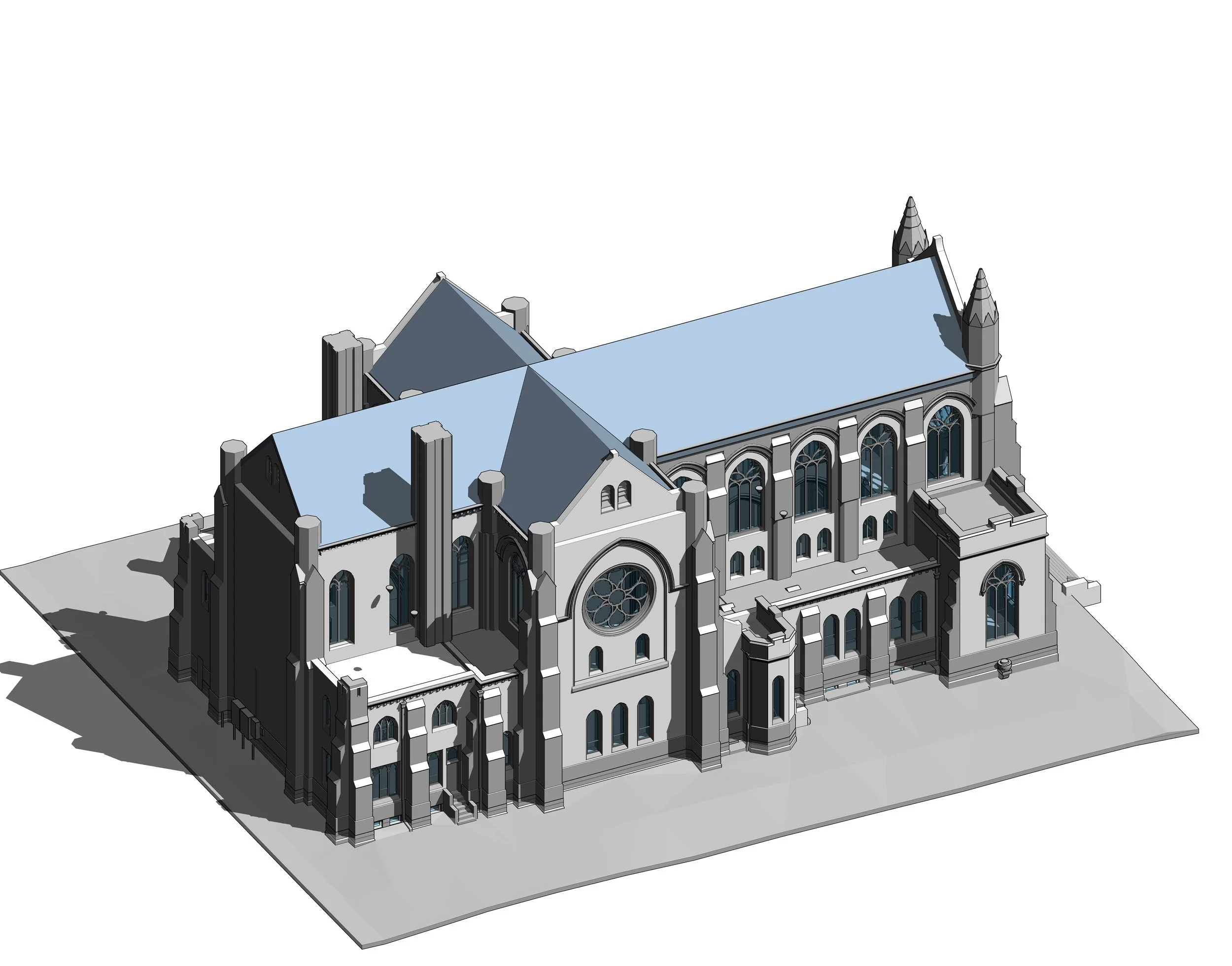
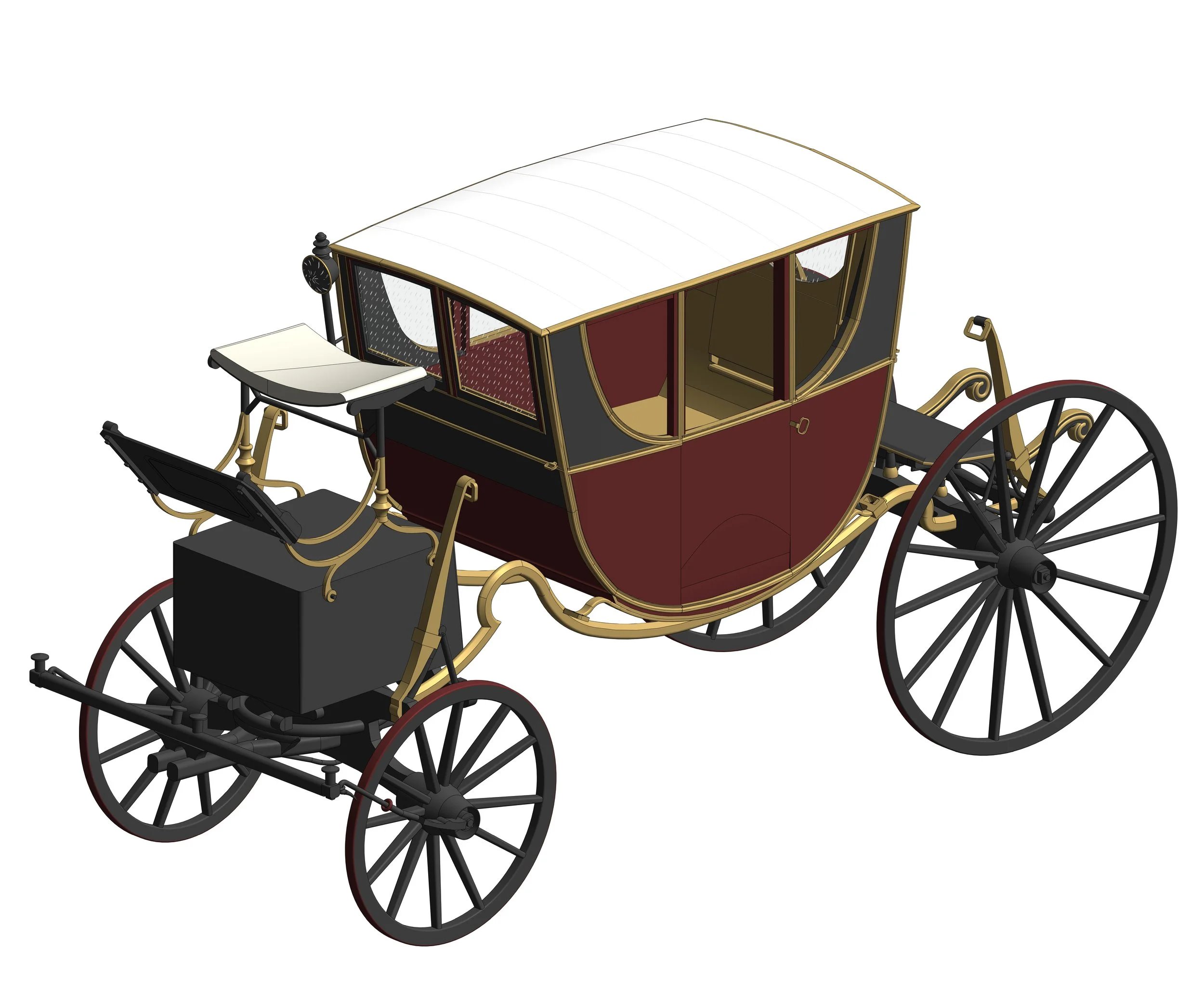
Scan to BIM
3D BIM modeling references site survey 3D image to create an accurate 3D model of your building and site. We start with your office template and families to create an efficient model that will save you time.

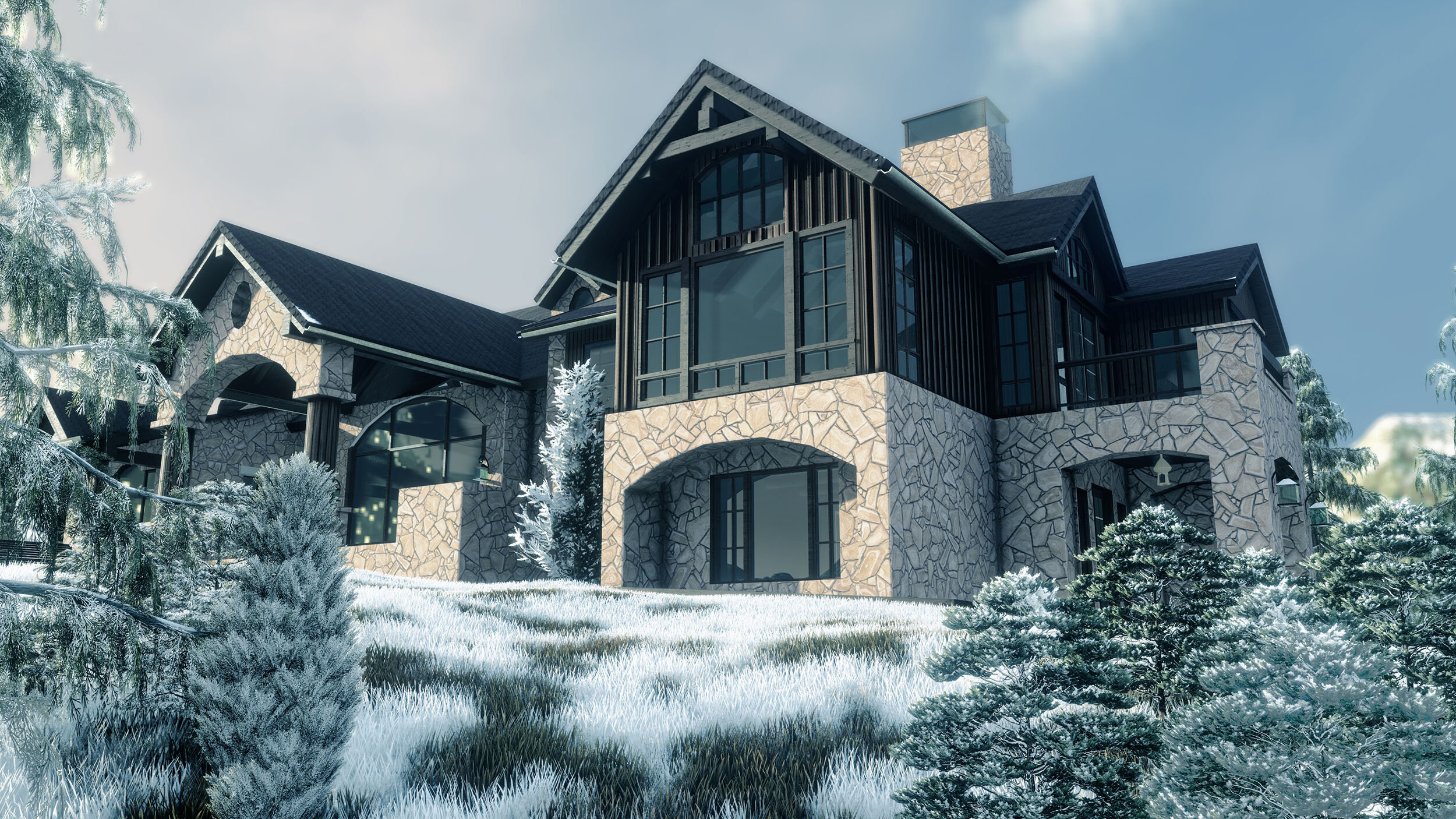
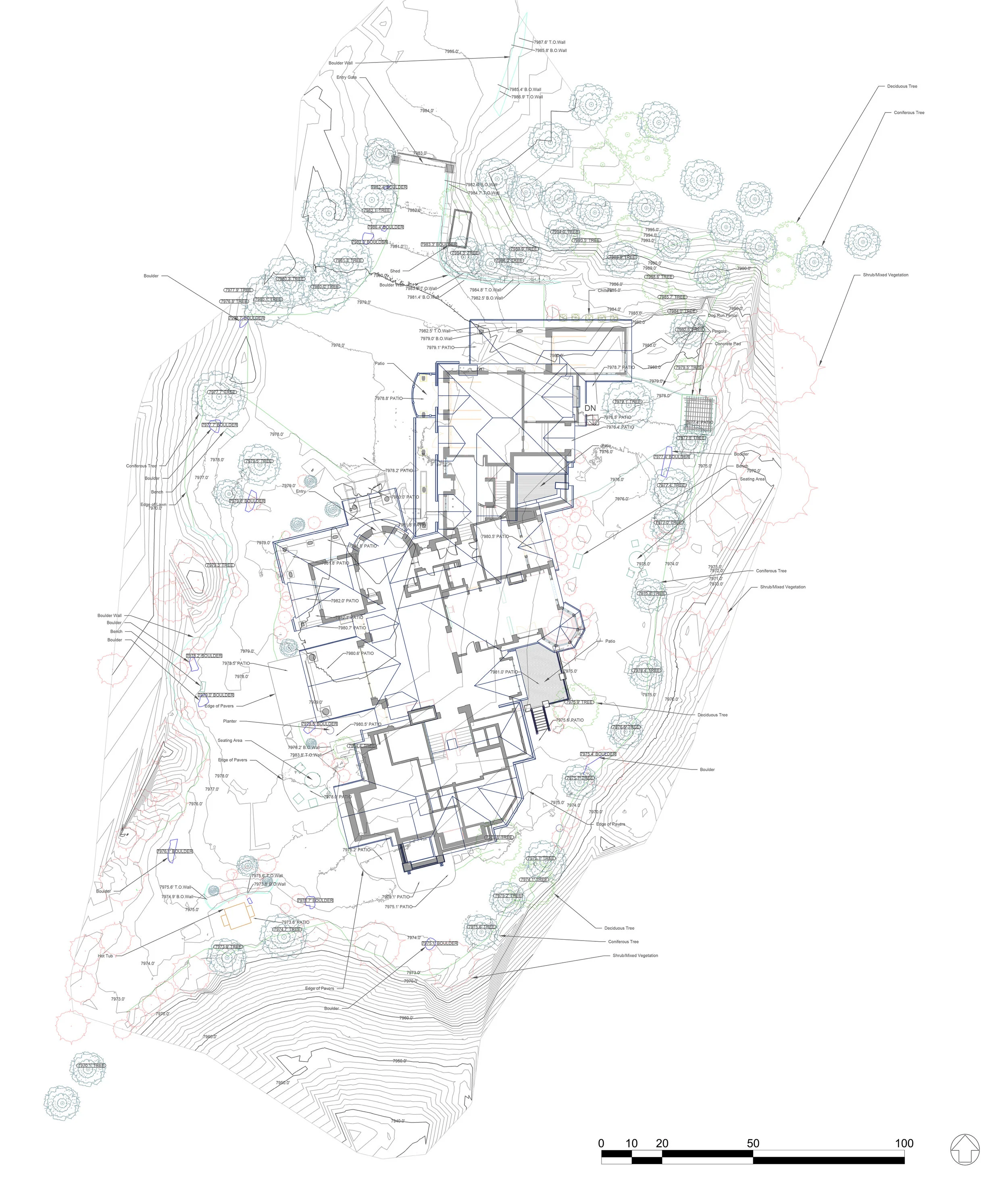
Architectural As-built drawing of Aspen, CO residence.
Scan to Architectural Drawings
Our team is experienced in creating construction documents for all types of architecture and engineering. We use line weights and graphical conventions to create a final drawing set when it’s required.
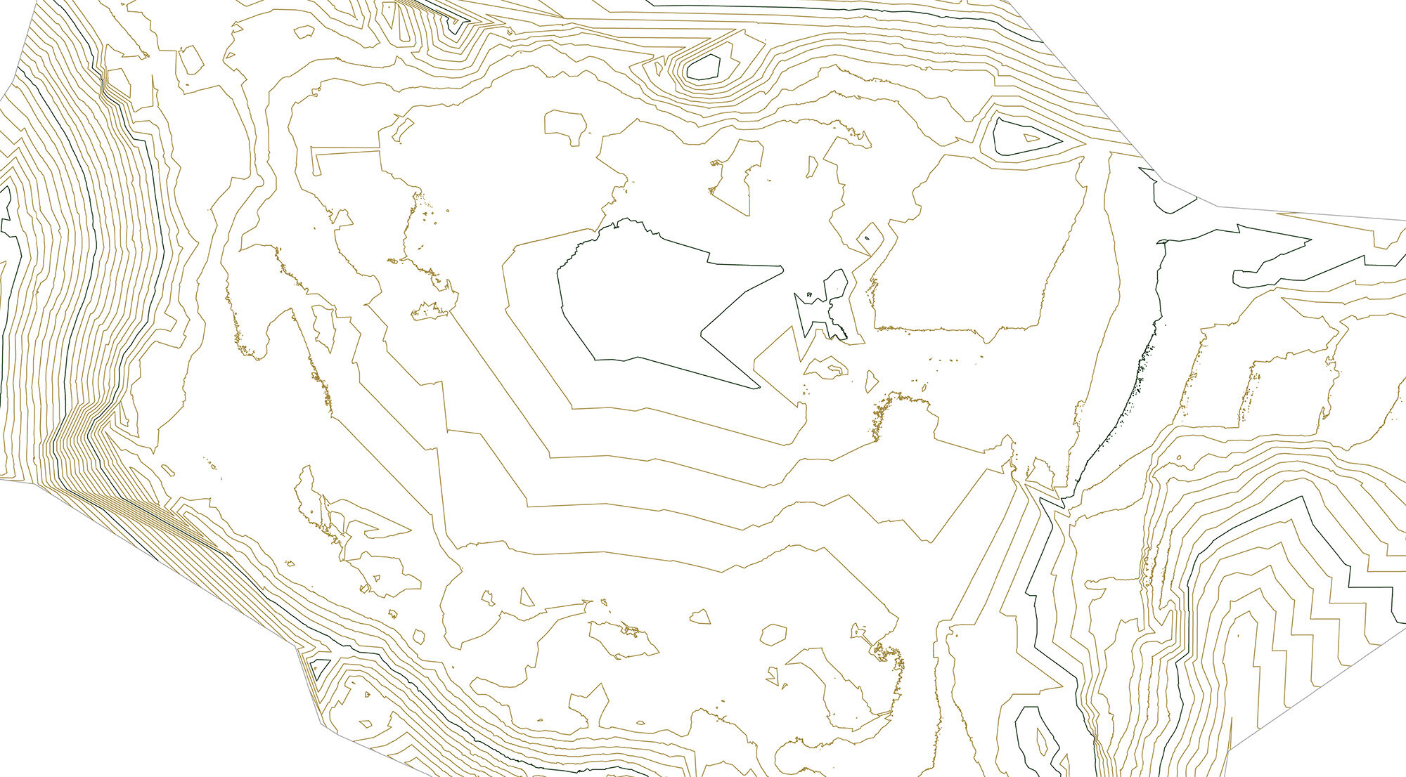
Drone data of topographic surface in Colorado.
UAV LiDAR to Topographic Surfacing
We can quickly create topographic surfaces and contour maps of large plots of land. By flying programmed drone missions above the site several hundred acres can be captured in a single site survey.
Our Site Survey Methods
In this data collection phase we consult local building codes to construct a thorough site survey plan, documenting mechanical, structural, and architectural systems and terrain plus site features. The array of gear and technologies we use is outlined here.

LiDAR image of 60’ tall sculpture in Denver, CO.
3D imaging (LiDAR)
We document building interior and exteriors, land, structures, utilities, and even incidents and accidents like floods, wildland fires, and explosions. Using cutting edge imaging technologies such as LiDAR, the latest software, and adaptive post processing techniques, our work will help you be more effective.

360 Photo of an Aspen, CO kitchen.
360 Photography | Matterport
360 tours save a trip to the site and aide in communication by providing a virtual walk-through. We use state of the art 360 cameras to capture the interior and exterior of buildings PLUS we host the 360 tour online for you. Sharing ideas is simple and clear with a 360 tour from 3D Data Pro.

Drone image of South Platte River Road in Denver, CO.
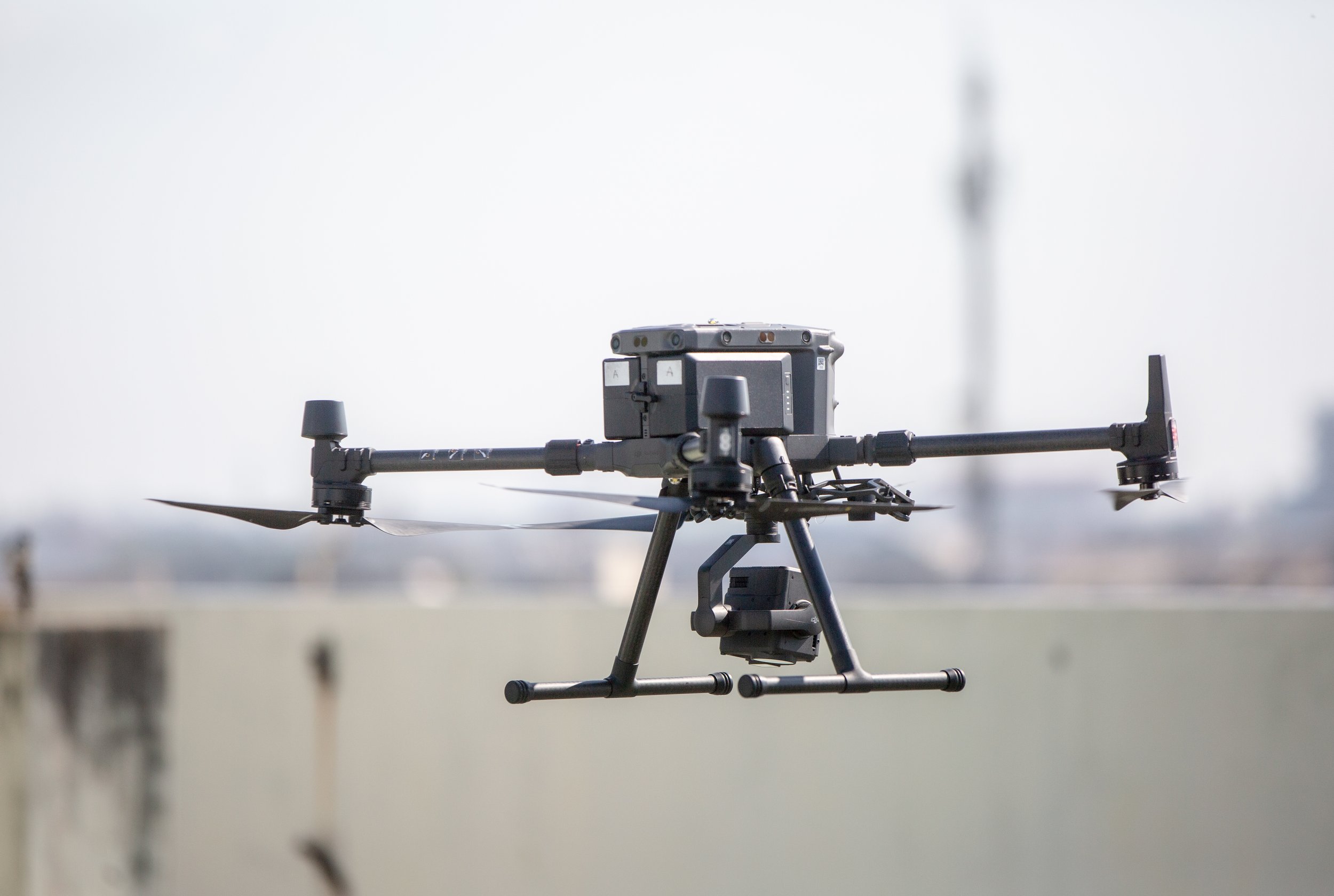
sUAS / UAV / Drones
We are certificated remote pilots under the Federal Aviation Administration Part 107 which pertains to commercial operation of small unmanned aerial systems sUAS . Our equipment is registered with the FAA and each mission is cleared with the Low Altitude Authorization and Notification Capability (LAANC).

Step 1a: Terrestrial Laser Scanning (TLS)
At 3D Data Pro, we use advanced Trimble 3D laser scanners to perform precise reality capture and site surveys. Utilizing LiDAR technology, these scanners accurately map walls, roof and floor systems, windows, doors, and structural elements, as well as intricate details like masonry textures, handrails, piping, and conduit.
Each scan undergoes rigorous alignment and quality control to create a unified, high-resolution point cloud. This data serves as the foundation for Building Information Modeling (BIM), CAD models, and other project deliverables, ensuring accurate documentation for design, construction, and facility management.
This video showcases how LiDAR technology captures roof surfaces with exceptional precision, demonstrating its value in providing reliable, detailed site data for seamless project execution.

Step 1b: Airborne Laser Scanning
For large-scale sites, airborne laser scanning (ALS) provides a fast, efficient, and comprehensive solution for capturing high-resolution spatial data. Using advanced LiDAR technology, ALS can quickly map vast areas with exceptional accuracy, making it ideal for topographic surveys, infrastructure planning, and large construction projects.
To ensure the highest level of precision, ALS datasets can be seamlessly integrated with terrestrial LiDAR scanning (TLS) using strategically placed survey control targets. This process enhances alignment between airborne and ground-based scans, maximizing both resolution and coverage. By combining ALS and TLS, we deliver a complete, highly detailed representation of the site, supporting better decision-making and project planning.
Step 2: 360 Tour
3D Data Pro creates immersive 360° tours by capturing high-resolution interior and exterior 360° photos of the site. These images are seamlessly linked using Matterport software, allowing users—including designers, owners, and subcontractors—to navigate the space virtually.
Additionally, we incorporate access points for drone photos, videos, site images, and graphic deliverables, providing a comprehensive visual representation of the project—all in one easily accessible platform. Our advanced 360° tour platform integrates both interior and exterior imagery into a cohesive experience.

Step 3: 3D BIM Model
Using point cloud data as a precise foundation, 3D Data Pro’s drafting technicians develop accurate, intelligent, and fully detailed 3D models in AutoCAD, Revit (most commonly used), Civil 3D, SolidWorks, or 3ds Max. Our deliverables include Building Information Models (BIM), customized to our client’s templates, ensuring seamless integration into existing workflows.
From site survey to a fully realized 3D BIM model, our team efficiently completes the process in under two weeks with multiple disciplines (architecture, structure, mechanical, electrical, plumbing) for buildings up to 30,000 square feet, delivering high-quality results with speed and precision.

Step 4: 3D Model Development
Many projects require comprehensive 3D modeling of the entire site, including the building’s interior, exterior, and surrounding terrain. At this stage, our drafting team utilizes the point cloud as a precise reference to construct the 3D model, supplementing it with data from 360° tours, site photos, and drone imagery to ensure accuracy and completeness.
Before beginning the 3D modeling process, we collaborate with you to define project-specific requirements, including a detailed building parts list (drafting scope of work) and Level of Detail (LOD) expectations. This ensures the final model meets your exact needs, whether for design, construction, or facility management. Our models are always drafted in-house by archtecturally trained staff.
Step 5: Deliverables
From site survey to a complete 2D as-built drawing set in PDF or .dwg (AutoCAD), 3D Data Pro transforms 3D site data into highly valuable, cost-saving deliverables. Our process integrates advanced reality capture techniques, ensuring accuracy and efficiency in every stage of documentation.
This video provides a comprehensive overview of our workflow. It begins with drone footage of the existing buildings, followed by a combined TLS and ALS dataset. It then transitions to an animation of the Revit BIM model, showcases key elements of the 2D drawing set, and concludes with site photos for reference. This seamless integration of data sources highlights our ability to deliver precise, actionable insights for design, construction, and facility management.
Our Work
This is what drives our passion! Before starting any project, we develop a comprehensive site survey plan to ensure accuracy, efficiency, and completness. For code review site surveys, we conduct a thorough review of local codes and requirements, allowing us to document critical systems, including HVAC, architectural, structural, and site conditions such as ramps, site elements, lighting, and vegetation.
Throughout every project, our advanced equipment, refined methodologies, high-performance computing, and industry-leading software work seamlessly together. We maintain close collaboration with you before, during, and after the project cycle to ensure the highest quality results.

What is the technology?
3D imaging, also known as LiDAR or laser scanning, is a highly precise method of measurement that enhances accuracy while reducing costs. This advanced technology offers a more efficient alternative to traditional measurement techniques, mitigating risk, improving confidence in project data, and increasing both safety and profitability.
LiDAR is particularly valuable for capturing detailed measurements of diverse sites, including buildings, bridges, landscapes, utility substations, tunnels, and more. Additionally, airborne laser scanning (ALS) captures high altitutude elements, terrerstrial laser scanning (TLS) captures accurate, high resolution low altitude elements, and ground-penetrating radar (GPR) is utilized to detect and map underground utilities, providing a comprehensive understanding of both surface and subsurface conditions.
Our Clients
At 3D Data Pro, clear and consistent communication is our top priority from day one. We believe that strong collaboration builds trust and lays the foundation for successful projects. Our commitment to responsiveness and transparency ensures that every client feels valued—and the feeling is mutual.
Our diverse clientele includes forensic engineers, interior designers, architects, surveyors, mechanical engineers, historic preservationists, general contractors, and real estate professionals, with our network continuing to expand. We take pride in our ability to seamlessly collaborate across multiple disciplines, delivering tailored solutions for a wide range of industries.
Visit our reviews page to hear firsthand about the experiences of our clients and the impact of our work.

Let’s Work Together
Please get in touch and we will contact you about beginning the proposal process.